 Graphical representation of all roads and streets in the United States. Source: All Streets, Ben FryWhat occurs when you make a digital representation of a single geographical issue, as the existing road network?This question has made an American named Ben Fry who has studied the relationship between aesthetics, graphic design and data visualization computer.
He has done an extraordinary map that contains all segments of routes currently available in the United States. The design includes 26 million lines spanning 48 U.S. states that are grouped in the center of North America.
A first conclusion that can be drawn is the division of this vast land area into two distinct worlds: one to the east with a large consolidation of urbanization and other West with an increased presence of wild spaces.
Another question that arises in view of this scheme is the huge influence of the geographic, ridges, rivers, lakes etc.. in the final form of the urbanized world.
Finally, fantastic design that follows the territorial division system approved by the Congress of the United States in the early nineteenth century and which cuadriculó the continent beyond the Ohio River for colonization orderly. A dream of reason and rational philosophy still perceptible in the middle of the graphic.
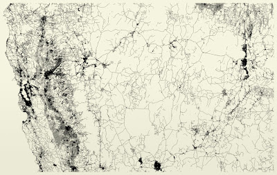
The Wild West identifiable even in the vicinity of San Francisco Bay, to the left of the image.
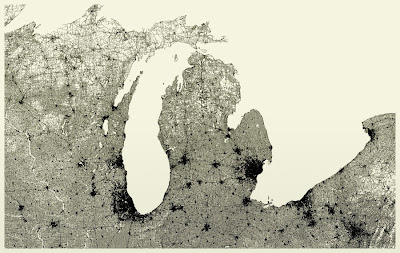
The cities of Chicago, left, the Detroit, in the center, on the edge of the great lakes that separate the United States from Canada.